Natural site
Bréhat Island
Île-de-Bréhat · Côtes-d’Armor
France’s first listed site, ten minutes by boat from L’Arcouest: a car-free island, flowery in the south, wild in the north, surrounded by an archipelago of pink granite. On foot or by bike.
- Suggested time
- A day, ideally a night on the island
- Type of place
- Car-free island, pink granite archipelago
- Atmosphere
- Island and peaceful, flowery in the south, wild and windswept in the north, set to the rhythm of the tides
- Getting there
- Boat from the Pointe de l’Arcouest, in Ploubazlanec, about 6 km from Paimpol: a 10-minute crossing, all year round. In 2026, a return ticket cost €11.90 per adult and €10.20 for ages 4 to 11 (Vedettes de Bréhat). Landing stage car park (€8 a day from April to October) or Cornec municipal car park (€9 for 24 hours, all year). Arrival at Port-Clos, at one of three slipways depending on the tide: up to 800 m of extra walking at low tide. Longer seasonal links from Saint-Quay-Portrieux, Binic and Erquy. No cash machine on the island.
Who this place suits
- With family
- 9/10
- As a couple
- 10/10
- With friends
- 9/10
- Solo
- 9/10
- With a dog
- 7/10
- Reduced mobility
- 5/10
These scores are calculated from what the page records: official rating, facilities, difficulty, duration and location. They are a guide, not a substitute for contacting the venue, especially about accessibility.
About
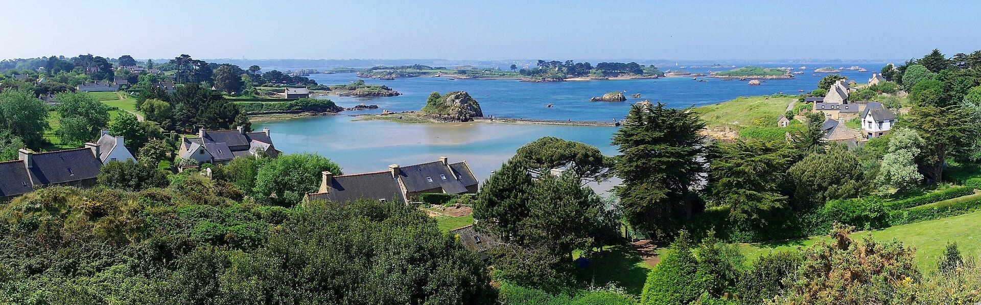
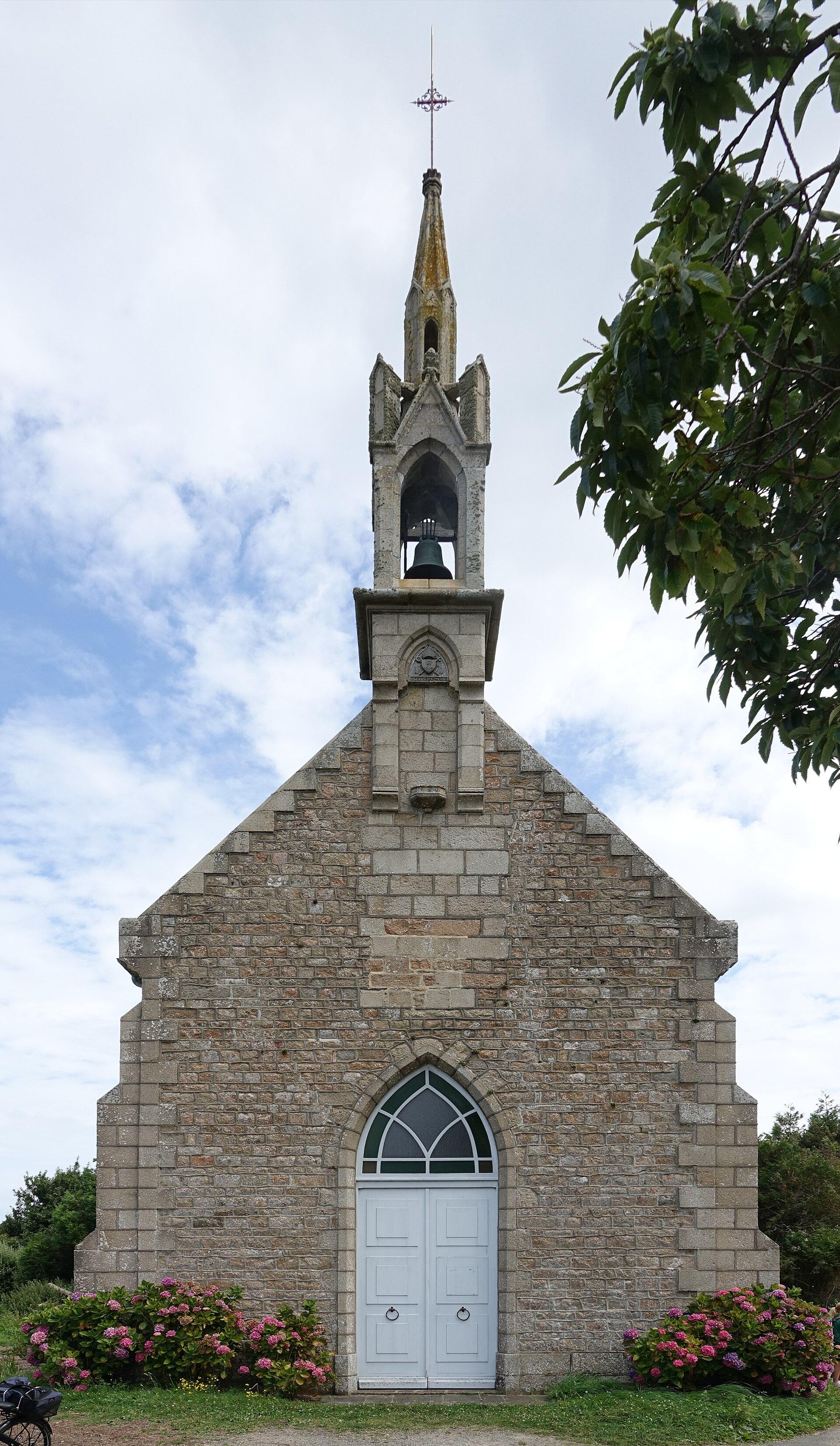
Bréhat lies about ten minutes by boat from the Pointe de l’Arcouest, off Ploubazlanec and Paimpol, in the Goëlo area. The main island is only about 3.5 km long and 1.5 km wide, 309 hectares in all, with 429 year-round residents (INSEE 2023). It is the heart of an archipelago of several dozen islands, islets and reefs, whose outline changes with every tide. Private cars are banned: you explore it on foot or by bike, passing only a few tractors and service vehicles. The island is made of two parts linked by the Pont ar Prat, the “meadow bridge”, often called the Vauban bridge. The engineer did come to Bréhat in 1695, but the bridge probably already existed; it was strengthened in stone in 1756. In the south, sheltered, the island is inhabited and full of flowers: the Bourg, the stone houses, the low walls, the agapanthus and hydrangeas that earn it the nickname Île aux Fleurs, thanks to a very mild winter. In the north, exposed to the wind, there is nothing but heathland, wet meadows and pink granite rocks as far as the Paon lighthouse: two different islands in one day. Bréhat was the first listed site in France, on 13 July 1907, a year after the first law protecting landscapes. The listing at first covered only municipal land; it was extended to the whole archipelago in 1980. The island is also part of the vast, mainly marine Trégor-Goëlo Natura 2000 site, and its north coast is listed as a remarkable natural area: it has a shingle bank where protected sea kale grows, and the Lenn de Kervilon lagoon. The surrounding islets are a refuge for seabirds, which are very sensitive to disturbance. The island’s history is maritime. Its sailors went cod fishing off Newfoundland from the early 16th century, its privateers made use of reefs only they knew, and Duguay-Trouin took refuge there in 1692. Reminders of this past include the Birlot tide mill, built from 1632-1633 and brought back into operation by an association since 1994, the Saint-Michel chapel, 33 metres up, which serves as a landmark for sailors, and the Second Empire citadel, now the workshop of the Verreries de Bréhat glassworks. The Paon and Rosédo lighthouses, blown up by the German army in August 1944, were rebuilt after the war. This small territory receives about 400,000 visitors a year. To avoid peaks, the municipality has regulated access on certain summer days since 2023, at around 4,700 visitors present at the same time; in 2026, this applied from 27 July to 21 August. The island is not closed, but it is best discovered in May, June or September, or by spending a night there, once the last boat has left.
What you will see
- France’s first listed site, since 13 July 1907, extended to the whole archipelago in 1980.
- An island without private cars, explored on foot or by bike, ten minutes by boat from the mainland.
- Two islands in one: the south full of agapanthus and hydrangeas, the wild north of heathland and pink granite, linked by the Pont ar Prat.
- The Paon lighthouse, at the tip of the north island, among a chaos of pink rocks where the sea rushes in.
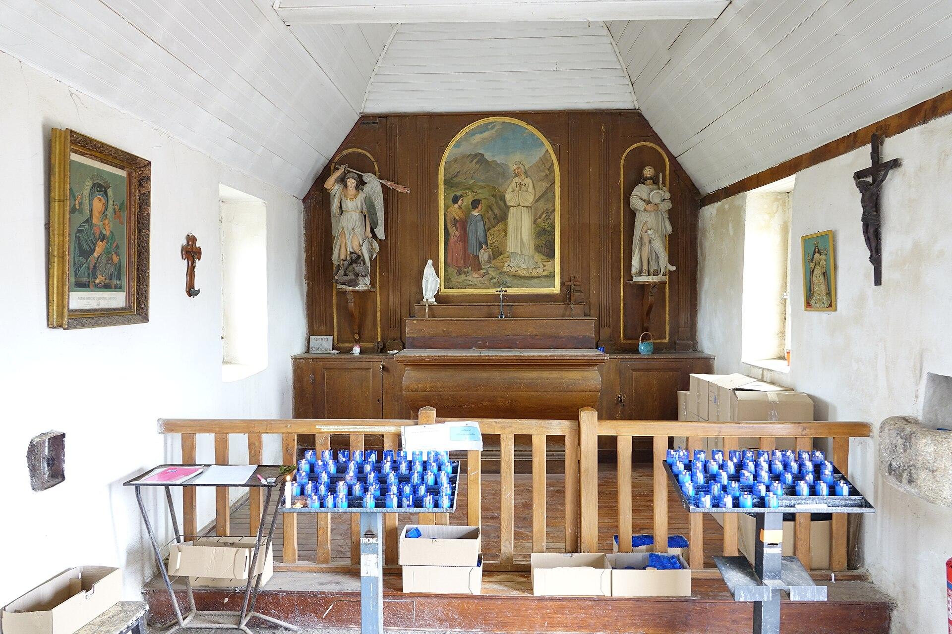
- The Saint-Michel chapel, 33 metres up, with one of the finest panoramas over the archipelago.
- The Birlot tide mill, built from 1632-1633, restored and able to grind again.
Show 4 more pointsHide
- An archipelago of several dozen islands, islets and reefs that changes with every tide.
- Guerzido beach, the main swimming beach, between sand and granite.
- The Verreries de Bréhat in the Second Empire citadel: glass-blowing workshops open free of charge.
- A coastal path of about 9.5 km and a full loop of about 16 km depending on detours.
Practical information
- Address
- 22870 Île-de-Bréhat
- Parking
- At L’Arcouest, landing stage car park €8 a day (April to October, 2026), Cornec municipal car park €9 for 24 hours (€18 over 2.10 m), first 30 minutes free, all year
- Pets
- On a lead at all times on the island. Not allowed in the Guerzido swimming area
- Accessibility
- Partial. The Bourg and main paths are easy; distant slipways at low tide, slopes and coastal paths are difficult. Wheelchair lent by the tourist office, little tourist train, passenger transport by reservation (€7.50 per trip in 2026)
- Best time
- May, June and September. In July and August, book and set off early
Tips on the spot
- In July and August, book your crossing. In 2026, access was regulated from 27 July to 21 August (about 4,700 visitors present at the same time), mostly on weekdays: set off early, or aim for the weekend, which is often less busy.
- There is no cash machine on the island: withdraw money on the mainland before boarding.
- Check the tide times: at low tide, the boat docks at the third slipway, up to 800 m and 20 minutes of extra walking. For a person with reduced mobility, arrive and leave around high tide.
- The Paon lighthouse is the furthest point: go there first, then come back via the Birlot mill, Saint-Michel, the Bourg and the Guerzido. You will avoid the crowds and will not miss the boat back.
- Half a day is enough for the south island only: Port-Clos, the Bourg, Saint-Michel, the Birlot, the Guerzido. Do not try to add the Paon at all costs.
Show 8 more tipsHide
- Coastal paths are for pedestrians only: by bike, stay on the authorised roads and tracks. In 2026, bikes could be taken to the island until about 9.30 am and brought back until 4 pm; you can also rent them on the island.
- Walking poles with metal tips are banned on the island: use rubber tips.
- Swimming at the Guerzido is not lifeguarded: keep an eye on children. Dogs, kept on a lead everywhere on the island, are not allowed in the swimming area.
- Do not pick flowers or collect pebbles, and keep away from the islets where birds nest. When foraging on the shore, put every stone you lift back in place.
- Wild camping is forbidden: the municipal campsite at the Pointe de Goareva opened from 1 May to 27 September in 2026, with no pitch reservations. Motorhomes are not allowed on the island.
- Take your litter back to the mainland when you can: waste is hard to deal with on an island.
- To walk less: the little train (about 40 minutes from the Bourg square, from April to All Saints) and a wheelchair to borrow from the tourist office, by reservation.
- Drones: listed site, Natura 2000, signal station and bird islets. Check the air and environmental regulations before any flight, and never fly over colonies.
Frequently asked questions
How do I get to Bréhat?
By boat from the Pointe de l’Arcouest, in Ploubazlanec, about 6 km from Paimpol. The crossing takes about ten minutes and runs all year round. Longer seasonal links also leave from Saint-Quay-Portrieux, Binic or Erquy.
How much does the crossing cost?
In 2026, Vedettes de Bréhat listed €11.90 return per adult, €10.20 for ages 4 to 11, free under 4. With the boat tour of the archipelago: €17.90 and €12.40. Prices change every year.
Can I bring a car to the island?
No. Private cars are banned. You only see a few emergency, farm or work vehicles. People get around on foot or by bike.
Can I explore by bike?
Yes: you can rent one on the island, or bring your own from L’Arcouest at limited times (in 2026, outward until about 9.30 am, return until 4 pm). The coastal paths remain for pedestrians only.
How much time should I allow?
A full day to see both islands. Half a day lets you discover the south island; two hours is only enough for the Bourg and Saint-Michel or the Guerzido. A night on the island is the best way to experience it.
How long is the walk around the island?
About 16 km for a full loop depending on detours, including about 9.5 km of coastal path. Allow 4 to 6 hours on foot.
See also all the nature in Brittany.
Stay in Île-de-Bréhat
Places to stay that are still available, with current prices, compared across the main booking platforms.
Partner link: a booking made from this map may earn us a commission, at no extra cost to you.
Read in the journal
- ChristmasWhat to do in Côtes-d’Armor during the Christmas holidaysDinan in winter, scallops, the birds of the bay and Cap Fréhel in the wind: our ideas for the 2026 Christmas holidays in Côtes-d’Armor.
- Winter holidaysWhat to do in Côtes-d’Armor in FebruaryPink granite in the wind, Cap Fréhel, Dinan, scallops and spring tides in the Bay of Saint-Brieuc: our ideas for the February 2027 holidays.
- SeasonWhat to do in Côtes-d’Armor at All Saints’Pink granite, Cap Fréhel, Bréhat, the scallop season and castles: our ideas for the 2026 All Saints’ holidays in Côtes-d’Armor.
Traveller reviews
Nobody has reviewed this place yet.
Photographs: JLPC · CC BY-SA 3.0 · Wikimedia Commons · Gordon Leggett · CC BY 4.0 · Wikimedia Commons · Gzen92 · CC BY-SA 4.0 · Wikimedia Commons