
Heritage site
Saint-Malo Intra-Muros
Saint-Malo · Ille-et-Vilaine
A walled city entirely encircled by 1,754 metres of granite ramparts, facing the Channel, to the rhythm of the highest tides in Europe.
- Suggested time
- A day
- Type of place
- Walled town and maritime heritage
- Atmosphere
- Privateer, stony and windswept
- Getting there
- Pedestrian old town, cobbles and steps; Saint-Vincent car park and Paul Féval park-and-ride with shuttle
Who this place suits
- With family
- 10/10
- As a couple
- 10/10
- With friends
- 9/10
- Solo
- 9/10
- With a dog
- 6/10
- Reduced mobility
- 6/10
These scores are calculated from what the page records: official rating, facilities, difficulty, duration and location. They are a guide, not a substitute for contacting the venue, especially about accessibility.
About
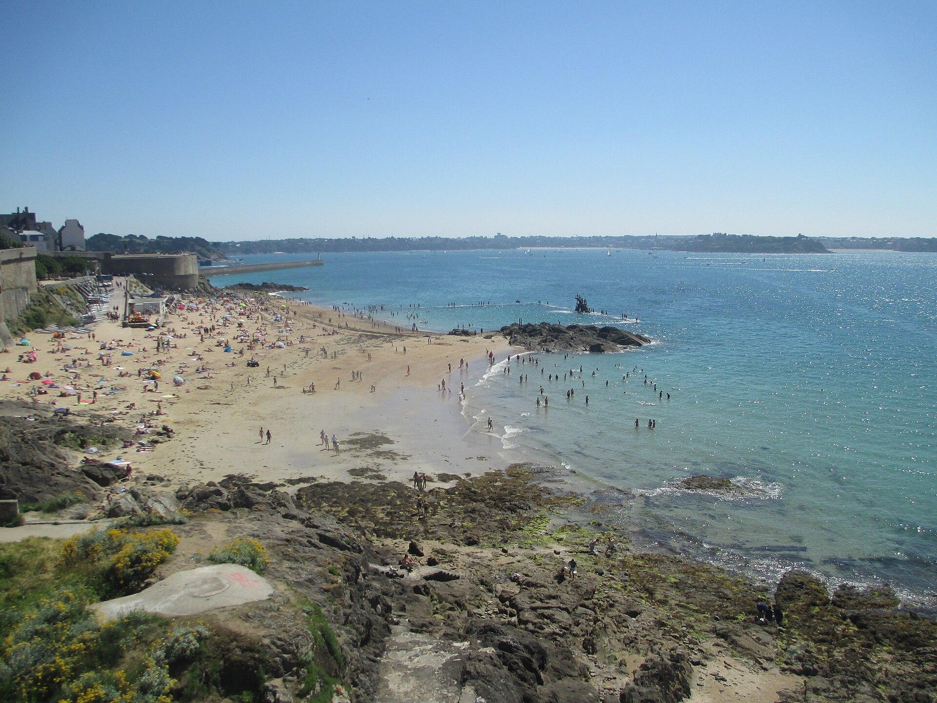
Saint-Malo Intra-Muros is 1,754 metres of granite ramparts that completely enclose a town, set on a rock at the mouth of the Rance, facing the open sea. The walk along the ramparts is about two kilometres long, it is free, and it remains the best way to understand the place: in an hour you see everything, the town packed tightly in on itself, the beaches at the foot of the walls, the islets, the forts out at sea, Dinard on the other side of the estuary. Listed as a historic monument on 12 July 1886, these ramparts are not all medieval. A few old sections survive, notably the Petits Murs between the Bidouane tower and the Hollande bastion, but most of today’s outline comes from the major works of the 17th and 18th centuries, carried out by the engineer Siméon Garangeau within the defensive system designed by Vauban. Between 1708 and 1742, the walled town grew from about sixteen to twenty-four hectares, because it had become too rich to fit inside its walls. That wealth has a name: privateering. A privateer is not a pirate, and the distinction is legal, not moral. A pirate acts on his own account, outside the law; a privateer receives from his government a letter of marque authorising him, in wartime, to attack enemy ships, his prizes then having to be declared and judged before being sold. Saint-Malo became one of France’s great privateering ports, and three names sum it up, whose statues stand along the ramparts: Jacques Cartier, who explored the gulf and the river Saint Lawrence for François I from 1534, René Duguay-Trouin, who would take Rio de Janeiro in 1711, and Robert Surcouf, the most famous, who captured the Kent in 1800 in the Bay of Bengal. But reducing Saint-Malo to its privateers would distort its history. The town’s fortune came just as much from long-distance trade, with Spain, the Americas, Africa, the Indies and China, and above all from cod fishing on the Grand Banks of Newfoundland, which sent thousands of sailors to sea for centuries. Shipowners built with this money: tall granite houses, packed tightly because space was short behind the walls, and malouinières, country houses where they could breathe. The Saint-Philippe bastion still lines up a few of them, facing the sea. It helps to know what you are looking at. In August 1944, during the fighting of the Liberation, Intra-Muros was bombed and ravaged by fire: of 865 buildings, only 182 survived, so about 80% of the buildings were destroyed or badly damaged. The ramparts held, and that is what saved the town’s outline. The reconstruction, led from 1948 to 1960 under the direction of Louis Arretche, first fixed that outline and the four sea fronts, then reorganised the interior more freely: modern structures, some widened streets, post-war comfort, behind granite façades and slate roofs. You often read that Saint-Malo was rebuilt exactly as it was: that is wrong, barely fifteen or so buildings were. What you visit is an old town combined with a remarkable heritage of the Reconstruction, and knowing that makes the walk more interesting, not less. Then there is the sea, which governs everything. The tidal range can approach thirteen metres, among the largest in western Europe, and the landscape is transformed within a few hours. At low tide you can walk to the Grand Bé, where Chateaubriand chose to rest facing the open sea under a nameless slab, and to Fort National, built in 1689 by Garangeau to plans by Vauban. At high tide, these same islets are rocks surrounded by water and the waves strike the walls. This is the only truly serious constraint of the visit: these crossings close, quickly, and no photo is worth being caught by the tide.
What you will see
- A free 1,754-metre walk round the ramparts, which encircle the whole walled town
- Fortifications listed since 1886, medieval in places, mostly the work of Vauban and Garangeau
- The Bidouane tower and the Hollande bastion, the two finest viewpoints over the town
- The Grand Bé and Chateaubriand’s nameless tomb, reachable on foot at low tide
- Fort National out at sea, built in 1689 by Garangeau to plans by Vauban
- Bon-Secours beach and its 1937 seawater pool, whose diving board has become an icon
Show 4 more pointsHide
- The shipowners’ houses on the Saint-Philippe bastion, built on the fortune of privateering and Newfoundland
- Saint-Vincent cathedral, from the 12th century, with the tombs of Cartier and Duguay-Trouin
- A tidal range approaching thirteen metres: the town changes its landscape twice a day
- Post-war Reconstruction heritage, behind the historic outline
Practical information
- Address
- Intra-Muros, 35400 Saint-Malo
- Public transport
- Saint-Malo station is served by TGV from Paris via Rennes, about 2 km from Intra-Muros, a 25 to 30 minute walk or a few minutes by bus. Ferry link to Dinard depending on the season.
- Parking
- Saint-Vincent underground car park at the foot of Intra-Muros, 481 spaces, very convenient but quickly full at weekends and during events. Paul Féval park-and-ride at the entrance to the town, around 3.30 € a day for a car and 7.50 € for a motorhome, the ticket allowing several people to take the bus link to Intra-Muros. Many paid car parks around the docks. Free on-street parking for those entitled to it. Prices and arrangements to be rechecked.
- Pets
- The outer walk and the ramparts are very easy with a dog on a lead. Access to monuments and forts varies, and beaches are regulated: animals are banned from Bon-Secours from April to September under the current tourist regulations.
- Accessibility
- A large part of the rampart walk is accessible, with three ramps serving different sections and an adapted route of about 800 m, or 1.6 km there and back, with little climbing. The full circuit is not entirely accessible: steps, changes of level and historic passages. The cathedral has an entrance from rue de la Blatrerie, opening onto the transept and nave. A Hippocampe beach wheelchair is available at Bon-Secours depending on the season. The Grand Bé and the Petit Bé are not wheelchair accessible, and Fort National has uneven ground.
- Best time
- May, June and September for the best balance between weather and crowds. Early morning or after 6pm for peace and quiet. Winter for storms and spring tides, with many places closed.
Tips on the spot
- Start with the walk round the ramparts: in an hour you will have understood the whole geography of the site
- Allow 1 h 30 instead if you take photos, read the panels and enjoy the views
- Check the tide times before any outing to the Grand Bé or Fort National, without exception
- Never set off on a crossing that is already partly covered: the sea comes in fast here
- Arrive before 9.30am: Intra-Muros is a different town early in the morning, before the coaches
Show 7 more tipsHide
- After 6pm, day visitors leave: it is the best time, along with early morning
- The ramparts are very exposed: bring one more layer than the sky suggests
- Cobbles and steps everywhere: comfortable shoes, and a baby carrier rather than a pushchair for the full walk
- Move away from rue Saint-Vincent to eat: the entrance streets are the busiest
- In high season, park at the Paul Féval park-and-ride and take the shuttle; the Saint-Vincent car park fills up early
- The castle houses the town hall: it cannot be visited like a castle museum, only on special tours
- For sunset, the Hollande bastion or Bon-Secours; for a photo of the whole town, the Môle des Noires
Frequently asked questions
What is Saint-Malo Intra-Muros?
The historic centre of Saint-Malo, inside the ramparts. The Latin expression means “within the walls” and does not refer to the whole town.
Is the town limited to Intra-Muros?
Far from it. Saint-Malo also includes Saint-Servan, Paramé, Rothéneuf, Rocabey and other districts. Saint-Malo, Saint-Servan and Paramé merged in 1967.
How long are the ramparts?
1,754 metres, and they completely encircle the old town. The walking circuit is about two kilometres.
How much time do you need?
An hour without stopping, more like an hour and a half to two hours if you take photos, read the panels and enjoy the views.
Are the ramparts medieval?
Only in part. A few old sections survive, including the Petits Murs between the Bidouane tower and the Hollande bastion, but most of the outline dates from the major works of the 17th and 18th centuries.
Since when have they been protected?
Listed as a historic monument on 12 July 1886.
See also all the heritage in Brittany.
Stay in Saint-Malo
Places to stay that are still available, with current prices, compared across the main booking platforms.
Partner link: a booking made from this map may earn us a commission, at no extra cost to you.
Read in the journal
- CalendarRoute du Rhum 2026 in Saint-Malo: the guideVillage from 20 October to 1 November, start on 1 November at 1:02pm, where to see the boats, park and stay: the guide to the Route du Rhum 2026 in Saint-Malo.
- ChristmasWhat to do in Saint-Malo during the Christmas holidaysA Christmas market at the foot of the ramparts, the walled city lit up, storms on the sea wall, Cancale oysters: our ideas for the 2026 Christmas holidays in Saint-Malo.
- SeasonWhat to do in Saint-Malo during the All Saints’ holidaysThe Route du Rhum village and start, the ramparts, the Grand Bé at the spring tides, the Grand Aquarium and Cancale: our ideas for All Saints’ 2026 in Saint-Malo.
Traveller reviews
Nobody has reviewed this place yet.
Photograph: Avi1111 dr. avishai teicher · CC BY-SA 4.0 · Wikimedia Commons