Viewpoint
Pointe de Kerpenhir
Locmariaquer · Morbihan
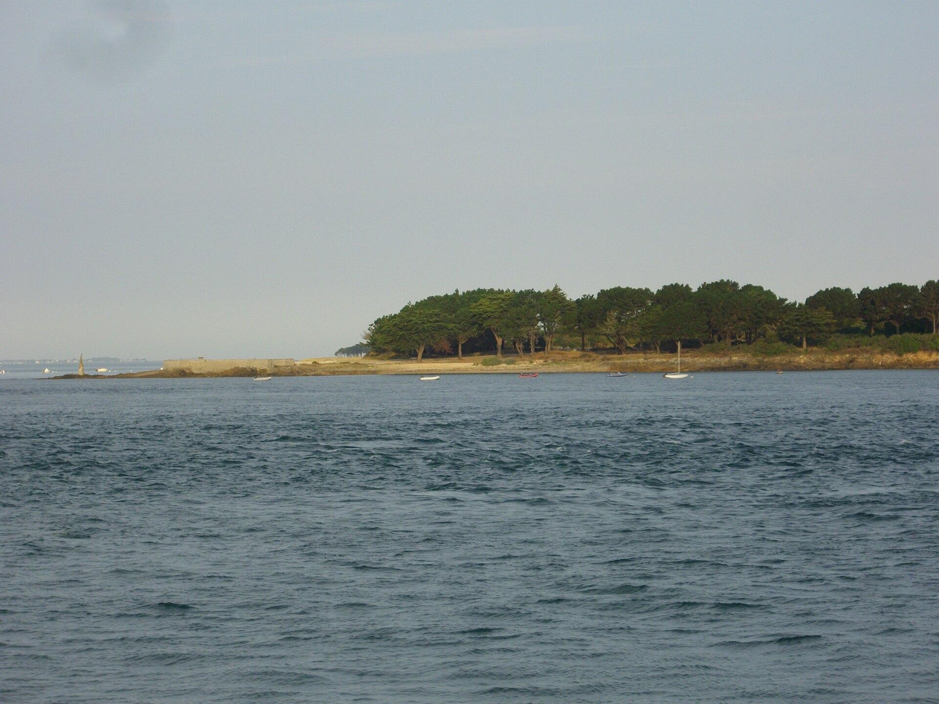
A spectacular headland marking the western entrance to the Gulf of Morbihan, facing Port-Navalo, with powerful currents, the statue of Notre-Dame de Kerdro and views as far as Houat, Belle-Île and Méaban.
- Suggested time
- 45 minutes to 1 h 30.
- Type of place
- Viewpoint
- Atmosphere
- Maritime, lively and very open, with a strong feeling of a sea passage.
- Getting there
- Easy access from Locmariaquer, then the coastal path; generally easy but natural ground.
Who this place suits
- With family
- 9/10
- As a couple
- 10/10
- With friends
- 9/10
- Solo
- 9/10
- With a dog
- 8/10
- Reduced mobility
- 7/10
These scores are calculated from what the page records: official rating, facilities, difficulty, duration and location. They are a guide, not a substitute for contacting the venue, especially about accessibility.
About
The Pointe de Kerpenhir lies at the tip of Locmariaquer, where the waters of the Gulf of Morbihan rush through the narrow passage facing Port-Navalo. The currents here are spectacular. The statue of Notre-Dame de Kerdro stands out among the rocks. On a clear day, the view reaches Méaban, Houat and sometimes Belle-Île. The coastal path also lets you continue to the beaches and the megaliths.
What you will see
- A view of the entrance to the Gulf of Morbihan, Port-Navalo, Méaban, Houat and Belle-Île depending on visibility.
- The headland marks the western mouth of the Gulf of Morbihan.
- The currents visible in the passage are among the most spectacular features of the site.
- Port-Navalo lies directly opposite, on the Rhuys peninsula.
- At low tide, the oyster beds become easier to see.
- The megaliths trail reaches Kerpenhir along the coastal path.
Show 1 more pointHide
- The statue of Notre-Dame de Kerdro is an iconic landmark.
Practical information
- Address
- Pointe de Kerpenhir, 56740 Locmariaquer
- Getting there
- Easy access from Locmariaquer, then the coastal path; generally easy but natural ground
- Public transport
- A car or bike is practical; local bus service varies
- Services
- In Locmariaquer
- Parking
- In the Kerpenhir and Locmariaquer area; use the authorised spaces
- Pets
- Yes, on a lead
- Accessibility
- Some nearby sections can be enjoyed with easier access
- Pushchair
- Partly possible depending on the path
- Difficulty
- Easy on the main paths
- Safety
- Do not go near the water where the currents are strong; take care on the rocks
- Best time
- A rising or falling tide to see the currents; beautiful light late in the day, all year round; spring and autumn are very pleasant
- Crowds
- Busy in season
- Photography
- Excellent for boats, currents, Port-Navalo and the statue of Notre-Dame de Kerdro
- Ideal for
- Families, photography, boats, couples, tides and currents
- Nearby
- Locmariaquer, Port-Navalo, the Locmariaquer megaliths, the Pierres Plates dolmen, the Gulf of Morbihan
Tips on the spot
- Check the local weather on the day; in fog or very poor visibility, postpone if the view is your main aim.
- Come in the morning or late in the day for softer light and fewer people.
- Bring a windproof and waterproof layer: the wind makes it feel much colder.
- Wear shoes with good grip; after heavy rain, paths can be muddy or slippery.
- Never cross a fence or safety marking for a better photo, and stay back from the cliff edge in strong wind.
Show 10 more tipsHide
- With children, be especially careful near cliffs, rocks and exposed areas; keep dogs on a lead.
- Stay on the paths to limit erosion, and take all your litter home.
- Do not count on toilets at the viewpoint, and bring water if the site is isolated.
- Do not fly a drone without checking the rules, and do not disturb seabirds.
- For sunset, plan your walk back after dark and bring a small torch.
- Check the tide to see the currents at their clearest.
- Never climb down onto the rocks along the channel in heavy seas.
- Bring binoculars to look at Port-Navalo and the islands.
- Combine Kerpenhir with the Locmariaquer megaliths.
- For a longer walk, follow part of the coastal trail towards the Pierres Plates.
Frequently asked questions
Why is it worth the detour?
It is one of the best viewpoints for understanding where the bay of Quiberon meets the Gulf of Morbihan.
What can you see?
The entrance to the Gulf of Morbihan, Port-Navalo, Méaban, Houat and Belle-Île depending on visibility.
What is the atmosphere like?
Maritime, lively and very open, with a strong feeling of a sea passage.
How much time should I allow?
45 minutes to 1 h 30.
Is the site free?
The viewpoint is free; some nearby heritage visits may be paid.
Can I come with a pushchair?
Partly, depending on the path.
Stay in Locmariaquer
Places to stay that are still available, with current prices, compared across the main booking platforms.
Partner link: a booking made from this map may earn us a commission, at no extra cost to you.
Read in the journal
- Region guideWhat to do in the Gulf of MorbihanThe Île aux Moines, the Île d’Arz, the Gavrinis cairn, Port-Navalo, Locmariaquer, Vannes and Suscinio: the guide to visiting the Gulf of Morbihan, its islands and its shores.
- ChristmasWhat to do in Morbihan during the Christmas holidaysChristmas in Vannes, the Pont-Scorff light trail, Rochefort-en-Terre lit up and Carnac in winter: our ideas for the 2026 Christmas holidays in Morbihan.
- SeasonWhat to do in Morbihan during the All Saints’ holidaysThe Carnac alignments open to walk among, the Gulf of Morbihan, castles, the wild coast and Lorient: our ideas for All Saints’ 2026 in Morbihan.
Traveller reviews
Nobody has reviewed this place yet.
Photograph: Fab5669 · CC BY-SA 4.0 · Wikimedia Commons